Camp Hero, Part 1
The weather was around 70 degrees even though it was only the first day of spring. The week prior it had rained record levels. This would affect our experience, because there was so much water in what I have always experienced as a generally dry locale. Of course, I have always visited Montauk in the dry summer months and this was, practically speaking, still winter.


 Map of the larger area; Camp Hero towards the lower right.
 Camp Hero map.


There were some mighty oaks in the woods.

The defunct radar station. The only one of its kind remaining.
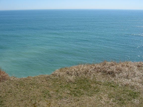
The cliffs and the ocean.
The maps: click on them for true size.
 Map of the larger area; Camp Hero towards the lower right.
 Camp Hero map.
Part 1: The Cliffs
We began from one of the several parking lots -this one at the cliffs, straight shot from the maine entrance. Later on, we drove deeper in to another parking lot for our hike.

One of the first things you notice are these signs. I think they are a bit old, and should be moved further from the cliff's edge. Surprisingly, there are no snow fences or other easy delineations along the edge.

My brother has a look, although at any moment the earth could give away.

The wind, waves, and ground water are having their way with the earth.

Looking southwest, along the shore.

Looking Northeast -in the distance is Block Island, with a bit of brown haze.

The hoodoos of Camp Hero.

The eroded soil can be seen here, coloring the water.

Comments
Post a Comment
Go ahead and comment! I will moderate and delete the spam. Thx