Feeling Out Boundary
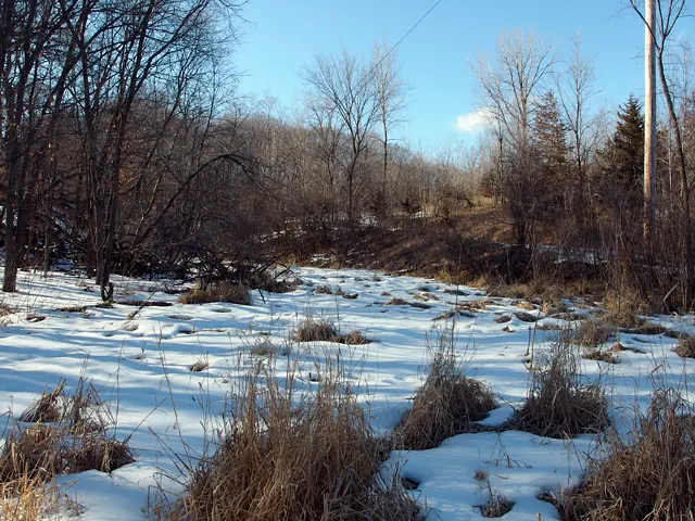
For years I have been looking across the wetland, visually leaping from this side to that. I hardly noticed it was a farming plot, hardly recall seeing corn or soy. When visitors see it from the upper floor in the snowy winter, they say how nice it is that we have a view of a lake, which is of course, an illusion. For quite some time I wanted to follow the edge of the wetland, crossing the wide drainage that marks southwestern boundary of our land, and I knew well enough this had to happen in winter. It turns out March is a good time, the soil is deeply frozen, and the air might be fifty degrees.
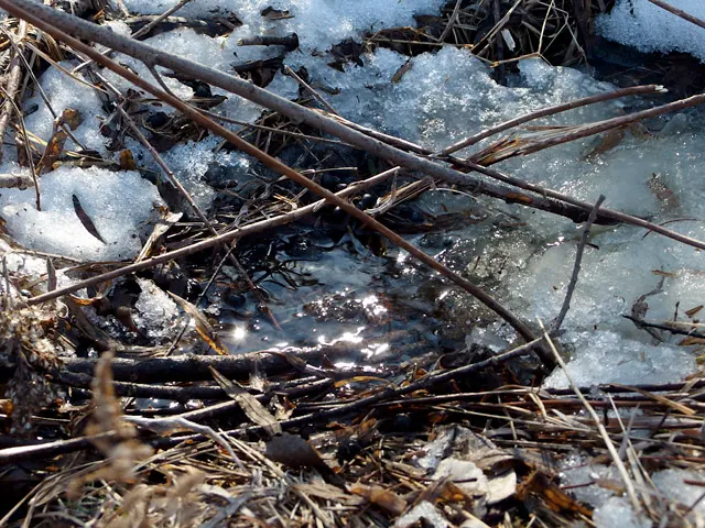
At the beginning of this great March melt, snow becomes puddles, ground frost begins to let go.
Water is beginning to move. A warmish day, sunshine, and then an attraction to any hint of burbling, the sound of moving water, is the first symptom of spring fever.
Crossing the wide drainage at the southwest corner of our lot where electrical infrastructure meets the woods, marsh grass and cattails meet the scoured land of the gravel mine. This is a boundary I've often met, but never crossed.
Along the western edge of the wetland we find the most Eastern Cottonwood, Populus deltoides. It likes wet feet, and can be found on wetlands, along streams and rivers, on lake edges, and occasionally upland. Large trees with trunks often bending and soft wood, they are prone to break. This is the source of its common name, I think, not the downy white fluff it distributes in late spring.
The wooded hillside slopes sharply, then levels out in a zone that accommodates occasional flooding. I have found that the four-legged and the two-legged creatures like to share paths whether made by us or by them. Here, we walk along a well-trodden deer path, one well-scoped by bow hunters.
As we gain on the farm field, the land rises up just enough to take it out of the soggy soil well-defined by the Cattails, Typha latifolia. Here I see a close resemblance to an oak savanna, a wonderful little spot containing grasses, annual and perennial plants, a large Bur Oak, Quercus macrocarpa (I think) and several smaller ones.
Growing too are large buckthorns with their countless berries. The oaks probably pre-date the buckthorn. New oaks are unlikely to be seeded, sprouted, and survive the shading without the regular fires that give oaks an edge.
Lichens (maybe orange Xanthomendoza weberi and grey-green Physcia aipolia) grow on even the lower oak branches. Rampant buckthorn growth will shade out the lichen too. I have to start seeing the positives of buckthorn, what were they again?
The farm road, which bisects the wetland and forces the drainage through a culvert.
The immaculate, stone free, black earth of the farmed hill to our south. I wonder why cover-cropping is not practiced in this region and have yet to do the research. I suspect that there might not be enough growing season to get soy or corn and sprout a cover before a freeze sets in, but then I am guessing. According to the MCWD, an agency that monitors our watershed, our sub watershed is draining phosphate-laden water to Dutch Lake. This field is near the head of the shed and yet another guess is that it's providing a good part of that input. Residential septic systems and lawn fertilizers are providing the rest.
My knee-jerk response is to worry that it soon will have homes on it. The owner leases it to a local farmer, and from what I can find, its owner does not live on the property which totals 68 acres of woods, wetlands, and farm fields (other than this farm field, which is isolated by topography, woods, and wetlands). A quick search shows the owner as Stone Arch Development, but a google search for that shows only a corporation named Stone Arch Organizational Development. Adding more complexity to property ownership, the notion that our own "development" is acceptable, but any future development should be off limits, or at least out of sight.
At the culvert, water flows in from the big marsh.
And flows out toward the south, draining another few miles of wooded hillsides, residential yards, and horse fields until it reaches Dutch Lake, and ultimately into Minnetonka, overtops into Minnehaha Creek, sent over the falls, then into the Mississippi, and off to a stint in the Gulf of Mexico.
Turning back to the north we get the only wide open view of the woods within which we live, apart from satellite views. The cropped view highlights the house, toward which I drew an arrow. Witnessing the open, bright marsh and dark woods together was an eye opening experience.


Comments
Post a Comment
Go ahead and comment! I will moderate and delete the spam. Thx